
Duck Creek Project
Project Summary
Duck Creek project lies in TRS 37N 73W Sections 15, 16, 21, 28, 2, 3, 4 and 9 in Converse County, Wyoming. The project covers a total area of 4,160 acres — 2,560 acres of state-land leases across Sections 15, 16, 21 and 28, and approximately 1,600 acres on federal land across parts of Sections 2, 3, 4 and 9. All is owned by UNXE238 Corp.
As estimated by WWC Engineering, there are 1.4–4.2 Mlb in the shallow Wasatch Formation, based on the resource estimation drawn from 1,492 drill holes — even though a total of 3,508 drill holes exist on the property. So, the real potential could be much more than that.
The real upside is the highly mineralized Fort Union Formation at 600–1,000 ft underneath the Duck Creek project. This is very likely, as the same sandstone hosts mineralization under Reynolds Ranch a mile to the west, and the same sandstone extends underneath Duck Creek.
Surrounding Deposits, ISR Operations & Active Exploration Projects
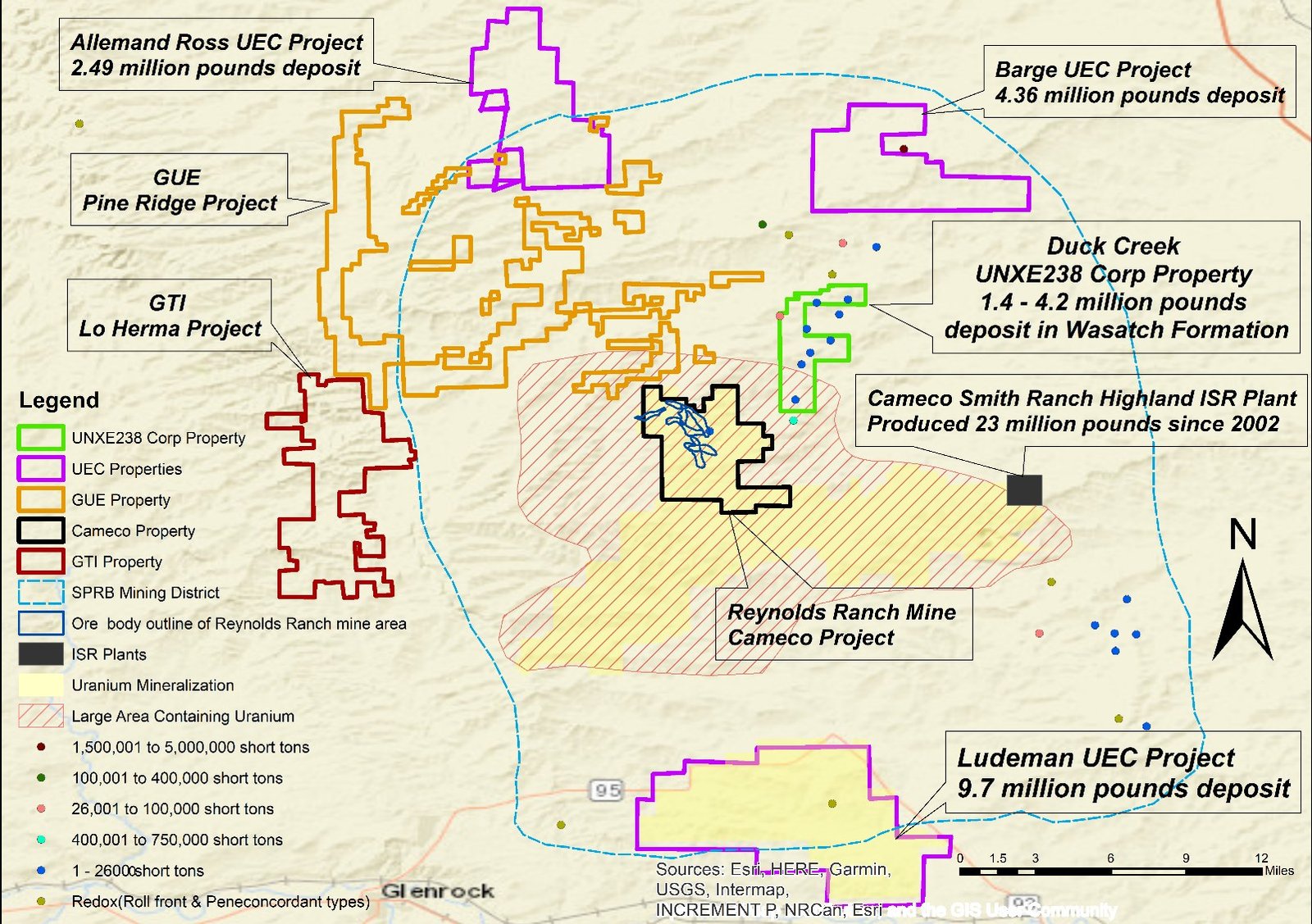
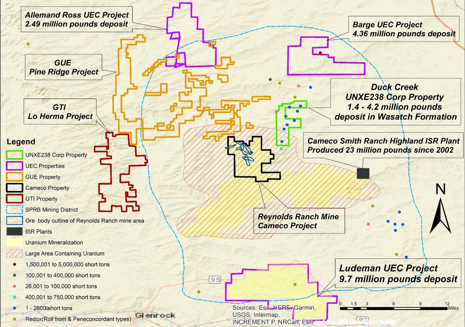
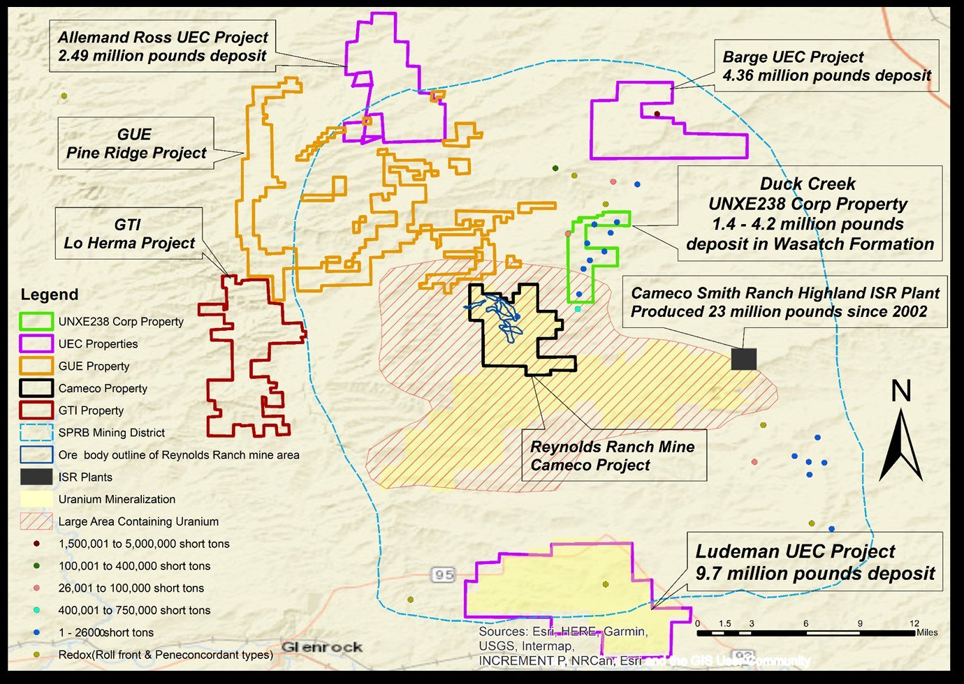
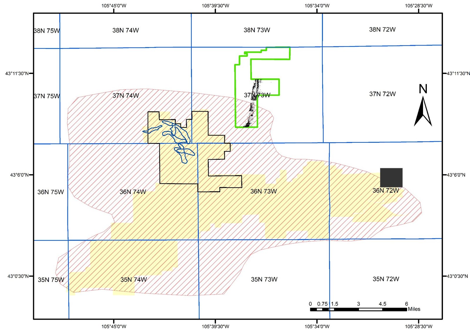
The project is about 5 miles, 7.5 miles and 12 miles south, southeast and north of the Barge, Allemand Ross and Ludeman projects of UEC, respectively. The project is about 1 mile northeast of the Smith–Reynolds Ranch deposits.
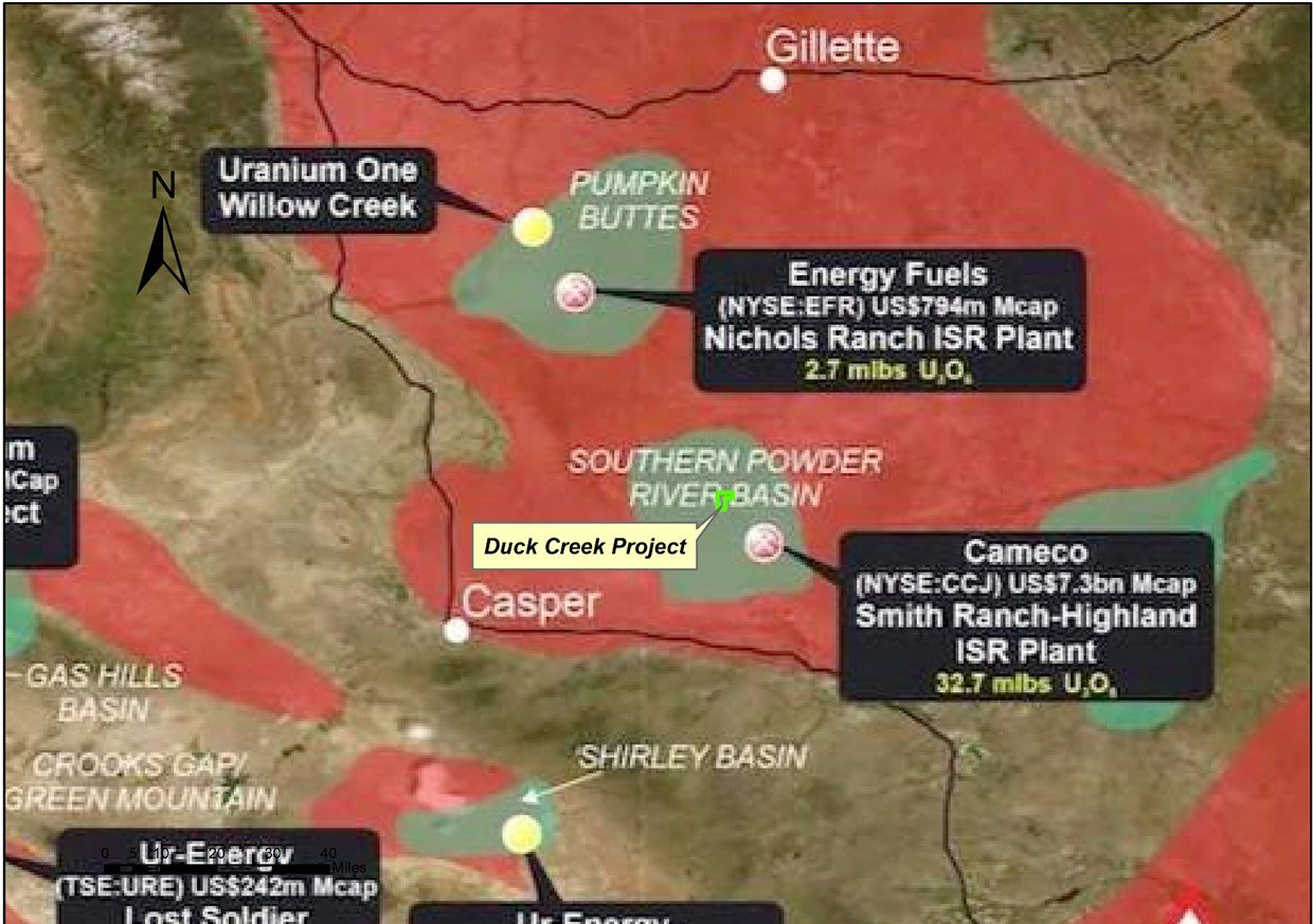
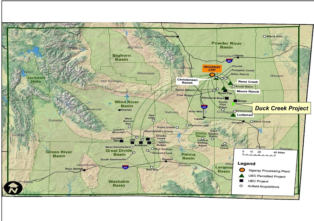
Located Within the Heart of the Southern Powder River Basin
Duck Creek project is located within the most prolific part of the southern Powder River Basin — surrounded by established licensed uranium operations, historic uranium mines, and active exploration and development-stage projects.
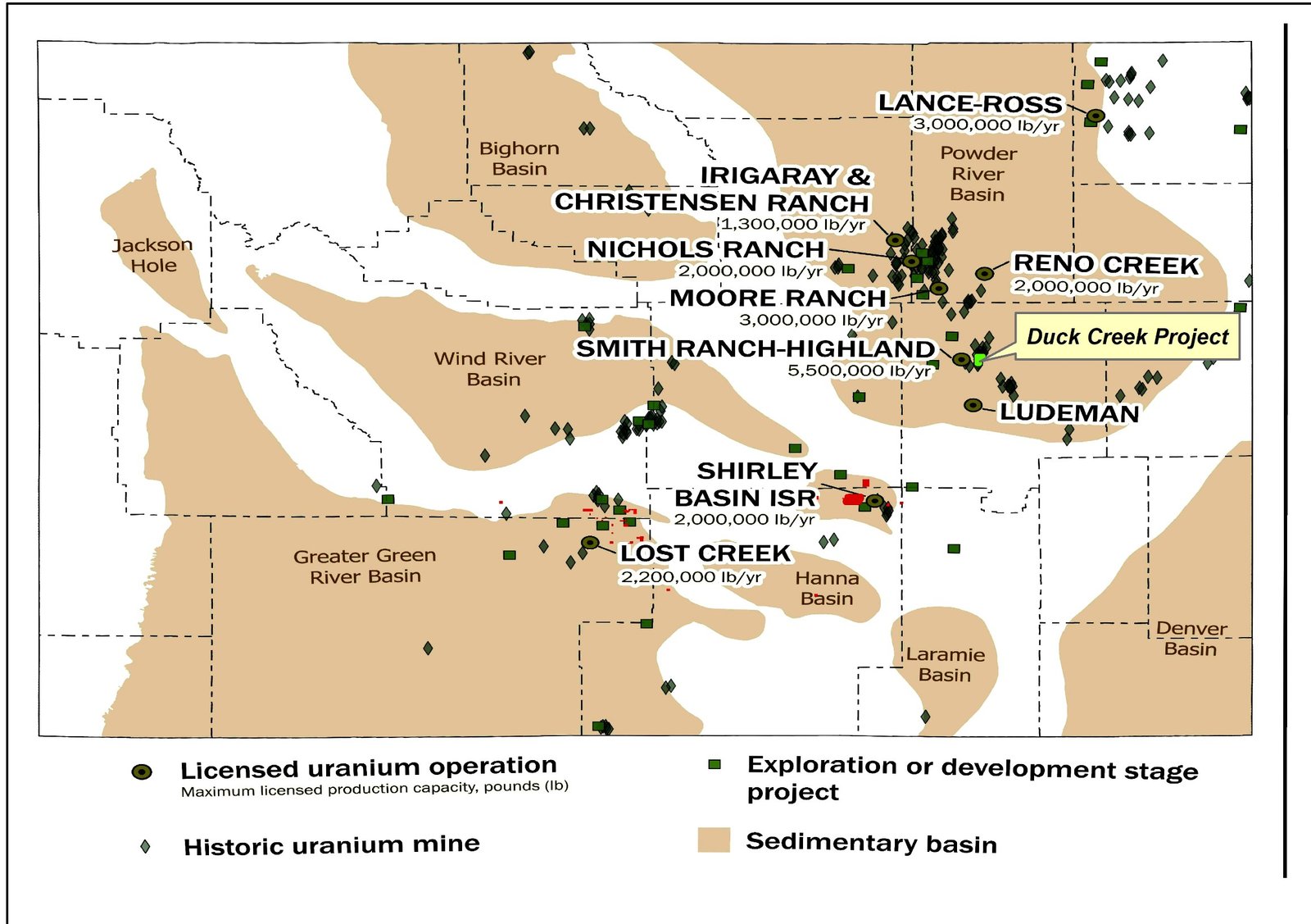
Duck Creek Project — Neighboring Operations
The projects located in the vicinity are Ludeman, Barge, Allemand Ross, Smith and Reynolds Ranch.
Cameco’s Smith Ranch–Highland ISR plant is located just adjacent to the project.
The inferred resource statistics of Allemand Ross are 1,275,000 tons of ore with 2.49 million pounds of U3O8.
The measured and indicated statistics of Barge are 4,301,000 tons of ore with 4.36 million pounds of U3O8.
The measured and indicated statistics of Ludeman are 5,334,000 tons of ore with 9.7 million pounds of U3O8.
Cameco’s Smith Ranch ISR plant has produced 23 million pounds of U3O8 since 2002.
Duck Creek Project, Surrounding Deposits & Historical Mines
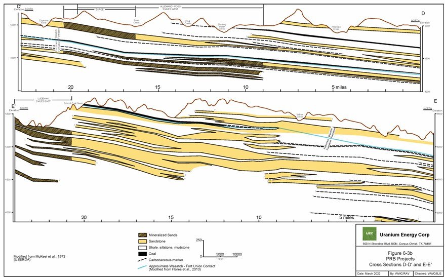
Mineralization Is Primarily in the Wasatch Formation
Drill Holes in Duck Creek Project
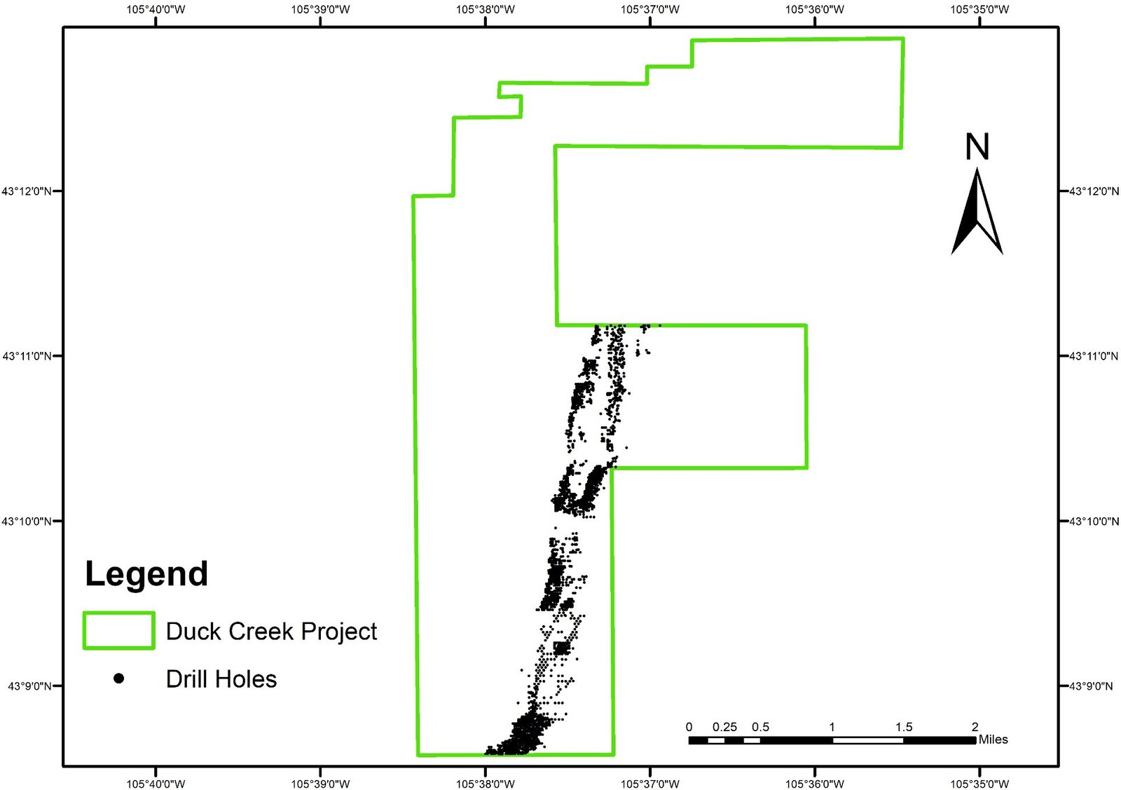
The Duck Creek Project is located in Converse County, Wyoming, spanning Sections 15, 16, 21, 28, 2, 3, 4, and 9 in T37N R73W. The project covers a total area of 4,160 acres, with 2,560 acres leased on state land (Sections 15, 16, 21 and 28) and approximately 1,600 acres on federal land (portions of Sections 2, 3, 4 and 9).
A total of 3,508 drill holes have been identified within the project. Of these, 1,492 drill holes have documented locations along with detailed information on mineralized zones, including depth to the top of the zone, thickness, and grade.
Highly Mineralized Grade (>700 ppm) & Mineralized Polygons (300–700 ppm)
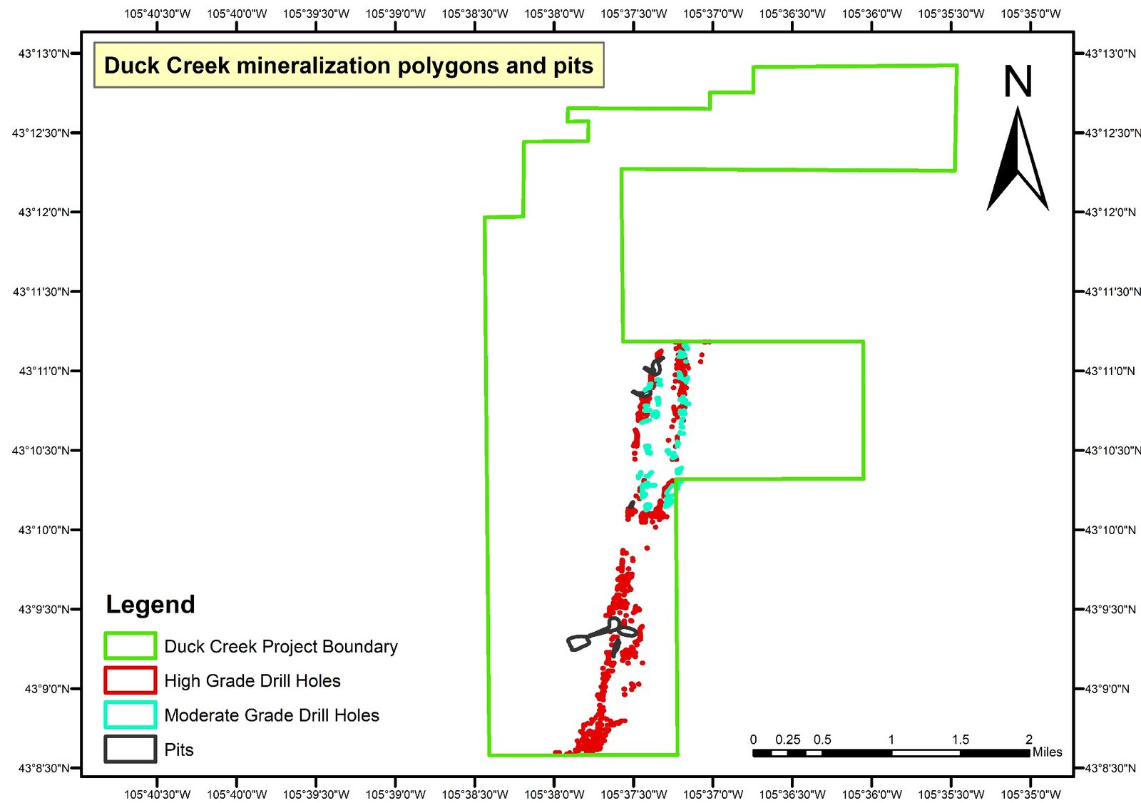
Note: it should be noted that there are a number of places where polygons around highly mineralized spots were not drawn.
Mineralization in the Region
The Barge project area to the north has mineralization in both the Wasatch Formation and the Fort Union Formation.
At the Barge project area, the “A sand” unit in the Wasatch Formation is the shallowest of four mineralized sand units.
The remaining mineralized sand units are in the Fort Union Formation. The A sand mineralized trend is located in the northern portion of the Barge project area and is approximately 4,500 ft long.
At the Allemand-Ross project area, the Fort Union Formation is divided into three members, with mineralized sands in the Lebo Member. However, in certain areas at the edge of the PRB, the contacts between members become uncertain and the Fort Union is broken up into two members, the Upper and Lower Fort Union Formation (Sharp and Gibbons, 1964). Mineralization at the Allemand-Ross project area is in five sandstone units, designated as the 10, 20, 30, 40 and 50 sands in ascending order. The thicknesses of the individual sand units range from less than 10 ft to over 150 ft.
Immediately to the east, in the Reynolds Ranch deposit, mineralization is primarily in the deeper Fort Union Formation.
Historic Mines in Duck Creek Project
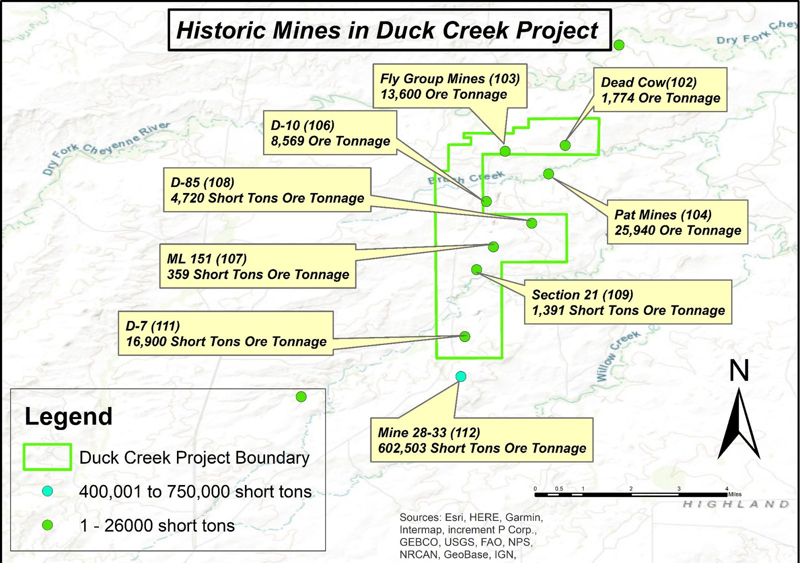
There were numerous historic mines found within the Duck Creek Project boundary.
- Historic mine D-85 — 4,720 short tons ore tonnage
- ML 151 — 359 short tons ore tonnage
- D-7 — 16,900 short tons ore tonnage
- Section 21 — 1,391 short tons ore tonnage
The short tons of all mines located within the project boundary were not produced fully and were abandoned due to the decline in uranium prices back in the 1990s.
Key Findings of the Project Interim NI 43-101 Report
Prepared by WWC Engineering. Detailed report will be released in the 2nd quarter of 2025.
Project Overview & Location
Project Description
- The Duck Creek uranium project is located in the Southern Powder River Basin (PRB), Wyoming, USA.
- The project spans 2,560 acres across four State of Wyoming leases in T37N, R73W, Sections 15, 16, 21, 28.
- BLM land on Sections 2, 3, 4 and 9.
- Infrastructure: the project area is near existing uranium mining operations, which can support infrastructure development (e.g., roads, utilities, workforce).
Historical Drilling & Uranium Resource Estimates
Historical Drilling Efforts
- Conducted by Kerr-McGee Corporation (pre-1980s)
- Total drill holes: 3,508
- Analyzed drill holes in resource prognosis: 1,492 (due to verified location and data quality)
- Number of uranium intercepts recorded: 23,136
- Average drill hole depth: 258 feet, with only 15 drill holes reaching 500+ feet
- Primary target formation: Eocene Wasatch Formation (shallow uranium deposits)
Uranium Metal Quantity Estimates
- Calculation based on grade-thickness (GT) factors and estimated mineralized area
- Estimation method: median GT and minimum GT applied to mineralized areas
- Upper range estimate (4.2 Mlbs U3O8) assumes a median GT of 0.598
- Lower range estimate (1.4 Mlbs U3O8) assumes a conservative cut-off GT of 0.201
- The data lacks geophysical logs and requires further drilling verification
Table: Estimated Uranium Resources in Wasatch Formation
| Estimate | Average Grade (%U3O8) | Grade Thickness (GT) | Area (sq ft) | Tons (000s) | Uranium Metal Quantity (Mlbs U3O8) |
|---|---|---|---|---|---|
| Upper Range | 0.05 | 0.598 (Median GT) | 5,895,866 | 4,241 | 4.2 |
| Lower Range | 0.05 | 0.201 (Minimum GT) | 5,895,866 | 4,241 | 1.4 |
Geological & Mineralization Characteristics
Host Rock & Deposit Type
- Primary uranium-bearing formation: Wasatch Formation (Eocene Age) — composed of sandstone units that host roll-front uranium mineralization
- Underlying formation: Fort Union Formation (Paleocene Age) — known to contain significant uranium in adjacent projects
- Exploration potential: deeper drilling could reveal additional roll-front deposits
Uranium Mineralization Process
- Type of deposit: roll-front uranium deposits, typical of Wyoming’s ISR (In-Situ Recovery) mining operations
- Formation process: oxygenated, uranium-rich groundwater migrates through porous sandstone
- When encountering a reducing environment (organic material, pyrite, etc.), uranium precipitates and forms roll-front deposits
Depth of Mineralization & Mining Implications
- Average uranium intercept depth: 111 feet
- Key issue: if deposits lie above the water table, ISR mining may not be feasible, and more expensive open-pit or underground methods may be required
Adjacent Uranium Mining Projects
Two major projects adjacent to Duck Creek provide resource benchmarks:
| Project | Owner | Measured Resources | Indicated Resources | Inferred Resources | Total U3O8 (Mlbs) | Avg Grade (%U3O8) |
|---|---|---|---|---|---|---|
| Allemand-Ross | Uranium Energy Corp. (UEC) | 0.4 Mlbs @ 0.09% U3O8 | 0.04 Mlbs @ 0.07% U3O8 | 2.5 Mlbs @ 0.10% U3O8 | 2.94 Mlbs | 0.10% |
| Smith Ranch-Highland | Cameco | 7.9 Mlbs @ 0.10% U3O8 | 17 Mlbs @ 0.05% U3O8 | 7.7 Mlbs @ 0.05% U3O8 | 36.2 Mlbs | 0.06% |
Deeper Upside Potential Underneath Duck Creek Deposit
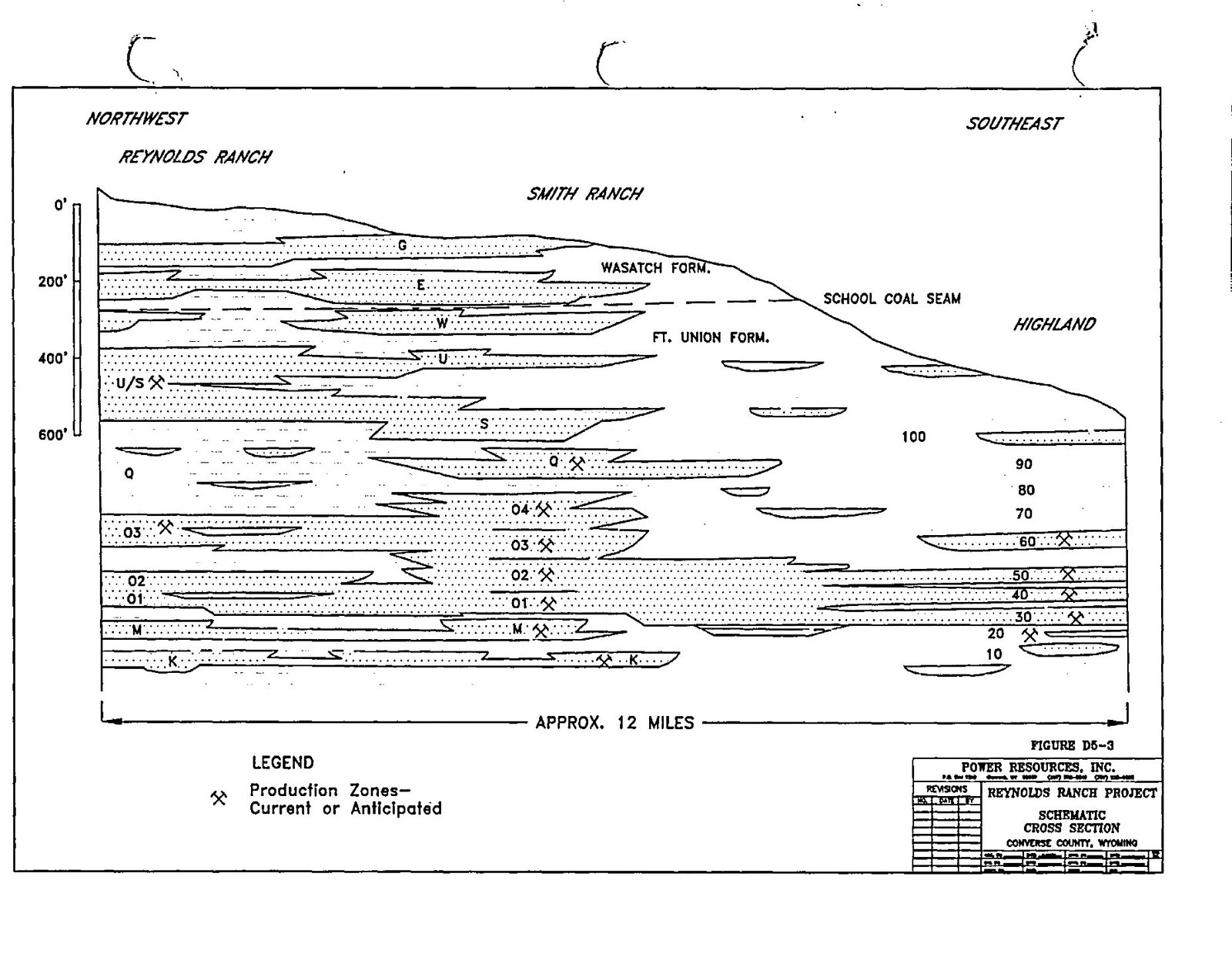
- Duck Creek deposit in the Wasatch Formation
- Mineralized units of Smith-Reynolds Ranch deposits
- Target sandstones in the Fort Union beneath Duck Creek
The Duck Creek deposit primarily lies in sandstone E of the Wasatch Formation, possibly amenable using the HPSA method.
While significant mineralization should be in the underlying Fort Union Formation — as encountered in Reynolds Ranch just 1 mile to the west.
Reynolds Ranch, Immediate West of Duck Creek Deposit
Conclusions
Current estimated resources: between 1.4–4.2 Mlbs U3O8 — possibly amenable by the HPSA method.
Upside potential: mineralization in the much thicker, highly mineralized Fort Union Formation.
Future work required: verification drilling, geophysical logging, geochemical analysis and a hydrological study.
A robust exploration program will be prepared in light of NI 43-101 in the 2nd quarter of 2025.
UNXE238 Corp. is actively looking for partners for a joint venture to advance exploration activities.
Recommendations for Further Development & Operations
Next Steps
- Prepare a non-coal Drilling Notification (DN) required by the Wyoming Department of Environmental Quality / Land Quality Division (WDEQ/LQD) in order to explore by drilling.
- Verification drilling, geophysical logging, and prompt fission neutron (PFN) logging could confirm historical estimates, provide disequilibrium data, and allow conversion to classified resources.
- Complete exploration drilling in the Fort Union to determine if additional mineralized zones are present.
- Water level data should be collected during exploration and verification drilling to determine which intervals are saturated.
- Core samples should be collected and tested in a laboratory setting to confirm the level of radiometric equilibrium, unless prompt fission neutron logging is employed.
Partnering to Advance Duck Creek
UNXE238 Corp. is actively seeking joint-venture partners to advance exploration at the Duck Creek project.